Mt. Indefatigable - Upper Kananaskis Lake
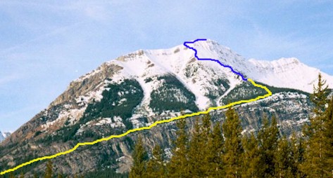
Basic route to the South Summit from
the Interlake parking lot
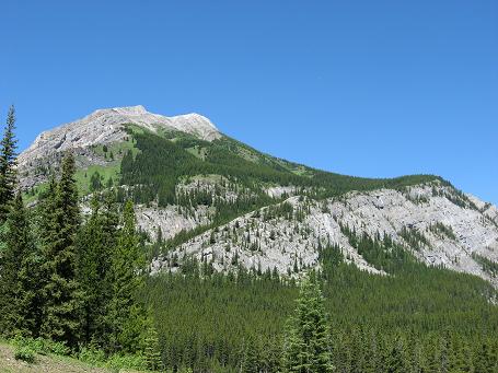
View from the parking lot

Heading counter clockwise around
the upper lake the trail heads right here

Leaving the lake trail and starting
north up the Mt Indefatigable trail

Trail opens up and follows the left
side of the ridge for a while

View of the middle part of the wide
ridge

Take the first left as the trail
levels out at the meadow

If you miss the first left here is
a second left although you have to do another left
in about 5 minutes to get back on
track

Here is the turn to get back on
track if you've taken the second left

Nearing treeline

The open slopes to the South Summit

Trail heads left to a rock rib
coming down from the summit ridge

The Lord is an artist also

From the rock rib ascend on the
left side then cross over to access the easiest spot for the summit ridge
There is a faint trail most of the
way

Here is the access point for the
summit ridge

Almost there, blue sky day!

Slightly higher point that we
traversed over to.
Say what!
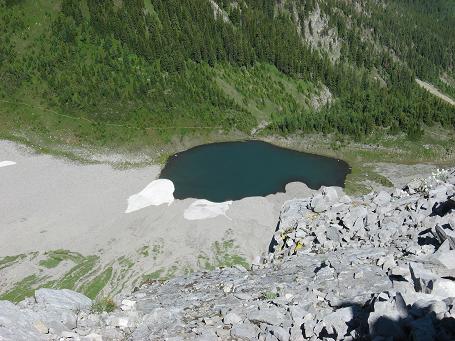
Tarn beside trail to the North
Summit

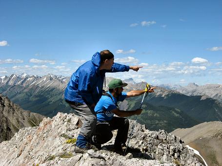
Mount Rae to the SE

Mount Joffre and the Aster Lake
area to the south

I should know this one looking
West?

And should know this one also to
the NW?
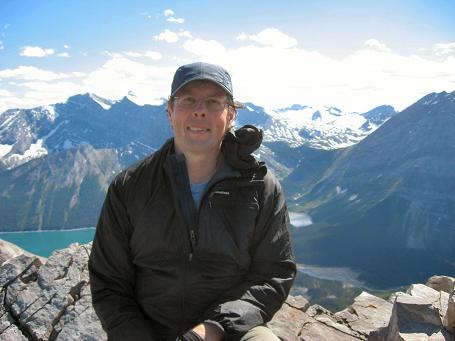
Old guy!

Point where we accessed the summit
ridge

Enjoyable descent!

The Lord will lift up the sinner's
head and make him shine!
Mt. Indefatigable South
Scramble: Class 1 – Steep Hiking
Altitude: 2,670m (8,758 ft)
Elevation Gain: 1,000m (3,280 ft)
Ascent Time: 2 – 3 ˝ Hours
Best Season to Scramble: Mid-June - September
Highlights
This scramble offers great views from the open ridge all the
way to the top. Great views of the Upper and Lower Kananaskis Lakes. Many people like
doing this one more than once (not to mean the same day though).
Getting There
Head west out of Calgary on the TransCanada highway # 1 for
79km (49.4 miles) and take the Kananaskis Country highway # 40 turnoff and head south. If
your base is Banff head east on the TransCanada for 52km (32.5 miles) and turn south on
route as above. Drive south for 49km (30.6 miles) and take the right hand turn into Peter
Lougheed Provincial Park. Follow this road for 15 km (9.4 miles) to the Upper Kananaskis
Lake parking lot. From this lot looking north you can see the long ridge on Mt.
Indefatigable.
Route Description
From the parking lot head counterclockwise around the lake.
After a few minutes of walking you will see a trailhead heading into the trees to the
right. Take this trail as it heads through the forest for 20 minutes or so and gains the
open left side of the ridge. In another 20 minutes or so you gain the ridge proper and the beginning of some great views. The way is obvious as you continue
straight up the ridge with a big drop-off on your right. The ridge is really wide so just
steep hiking here. Just as you make it to the top of the ridge and the incline levels off
you take the first trail to your left. If you look straight up at this point you can see
the antennae at the south summit. Follow this trail generally heading in the direction of
the summit. When you reach tree line the trail climbs diagonally left to a rock rib that
comes halfway down from the summit ridge. Continue on and then to the left of this rock
rib and then traverse a short distance left again to gain the summit ridge. A nice plod to
the top is all that remains. Return the way you came.
This peak was my first scramble and at that time the upper slopes were
covered with a half a foot of snow. We definitely missed the easier route. Our group went
straight up towards the summit and let me tell you it got pretty steep. When I got home my
mind kept replaying possible mishaps on a slope like that. Some how I continued my
scrambling career and it was nice to later discover an easier route to the top.